
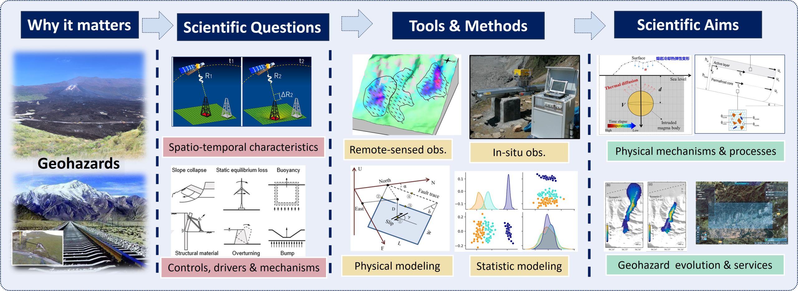
The overall roadmap of our research
The current topics of focus are listed below

Imaging Geodesy Techniques
We are developing imaging geodesy techniques to more accurately quantify topographic changes (ranging from sub-millimeter to tens of meters) on the Earth’s surface at the “pixel” scale. The aim of our research is to advance techniques that characterize ground/crust deformation with higher spatial and temporal resolution, accuracy, efficiency, and the ability to capture multi-dimensional information for complex scenarios. At present, our primary focus includes:
- Advanced multi-temporal InSAR methods for measuring small ground deformation
- Optimized sub-pixel offset tracking algorithms for measuring large-gradient surface displacements
- Robust digital elevation model (DEM) differencing algorithms for measuring large topographic changes with multi-source data
- Novel methods for spatio-temporal data fusion and analysis (e.g., statistical inference, artificial intelligence, and error propagation theory)

Mountain Permafrost Dynamics
Global warming continues to intensify the degradation of permafrost. In high mountain regions, permafrost degradation poses a significant hazard to infrastructure. Rock glaciers, one kind of periglacial landform, serve as the best indicators of permafrost occurrence in high-mountain areas. We are now working on the investigation the rock glaciers in high mountains in west China (Tibetan Plateau) using various geodetic imaging techniques, combined with in-situ measurements, aiming to quantify their distribution, kinematics, and dynamics. Our ongoing studies on rock glaciers include:
- Rock glacier inventory assisted by InSAR and machine learning
- Rock glacier creep characterization using multi-temporal InSAR
- Rock glacier ice content inversion and their hydrological significance
- Mechanism of rock glacier dynamics using physical modeling
Tectonic Deformation Measuring & Modeling
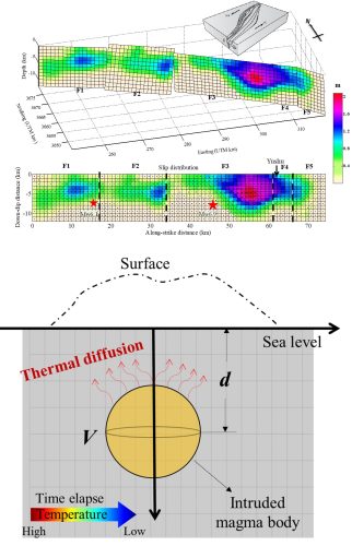
Earthquakes and volcanic activity are the most prominent tectonic activities on the Earth’s surface and are also the most destructive natural disasters. Precisely measuring the surface deformation corresponding to different processes of these tectonic activities is the most direct means of understanding and recognizing their developmental mechanisms. Combining observations of surface deformation with geophysical model simulations is of great significance for revealing the patterns of regional fault activity and assessing the medium- to long-term risks. Moreover, accurately quantifying and modeling the surface deformation signals of tectonic activities are also crucial for inferring the changing characteristics and mechanisms of large-scale non-tectonic activities (such as permafrost degradation and surface hydrological loading/unloading). Our current main focus includes:
- Source parameter inversion constrained by multi-source geodetic data
- Inferring and simulation of tectonic and non-tectonic deformation
- Volcanic activity in Southeast Asia and its impact on the local infrastructure safety